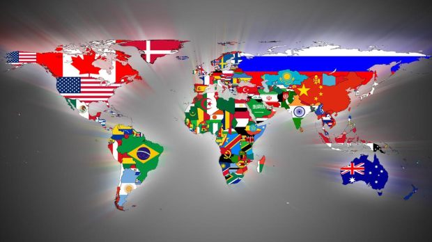
How the borders of the American countries have changed since colonization. By Katia Novella Miller
Lee este reportaje en ESPAÑOL – Leggi questo report in ITALIANO
Today’s American national boundaries were determined by global power in the past: Spanish America , Brazil and The Caribbean – PART II
By Katia Novella Miller
Part II
“The first step in liquidating a people is to erase its memory. Destroy its books, its culture, its history. Then have somebody write new books, manufacture a new culture, invent a new history. Before long that nation will begin to forget what it is and what is was… The struggle of man against power is the struggle of man against forgetting”
Milan Kundera
REPORT/Long Reading. Probably everybody knows American Spanish speaking countries were once part of the one-time famous (though very blurred) Spanish Empire, which preceded the Anglo-Saxon Empires of our days as a global power, while Brazil was a Portuguese colony and was part of the Portuguese Colonial Empire. But were their borders as they are today? Did Spanish America include also Asian territories? How did Great Britain obtain Belize? Did Denmark and Sweden also have colonies in the Caribbean? Here I will give you an overall idea of how this part of the world has evolved since colonization. A knowledge that will help you to understand, or at least have a clue, about what has really happened and why things are as they are today.
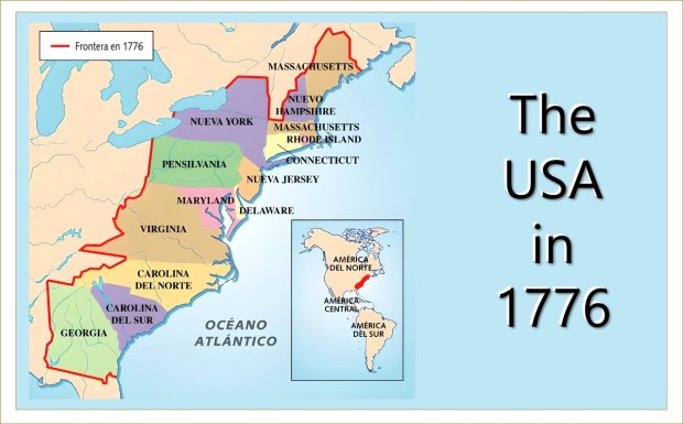
In the First Part of this report we have analyzed in broad terms how Canada and the United States of America transformed themselves to their current shapes (and into a superpower of our time), annexing Swedish, Dutch, French, Russian colonial territories and waging war against the Spaniards and later on against Mexicans. I want to stress again that in this report I am focusing exclusively on the conflicts among Europeans in order to assert their domain on lands inhabited by Native American peoples. But those wars against Native Americans are not the subject of this report. After clarifying this, let’s see how the countries included in the political term ‘Latin America’ have obtained their present borders.
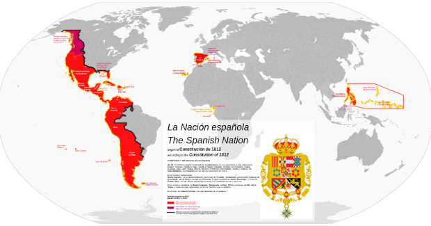
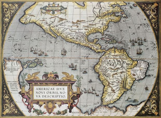
SPANISH AMERICA, IN OTHER WORDS: THE SPANISH EMPIRE
Following Christopher Columbus’ first expedition in 1492, in which he probably visited the Bahamas, Cuba, La Hispaniola (Haiti and Santo Domingo) and Puerto Rico, effective Spanish settlement began in 1493, when Columbus in his second voyage brought livestock, seeds, and other basic things to La Hispaniola.
In his four expeditions Columbus landed and claimed for the Spanish kings many American territories, many Lesser Antilles islands, the Greater Antilles, lands in Central America and in Northern Atlantic South America, supposedly in present Venezuela.
Coming from a (European) culture which gave great value to private propriety, material riches, greed and cruel selfishness, as it is widely known Columbus “oversaw a murderous quest for material riches that resulted in the utter demise of people”: tens of thousands Native Americans died in his pursuit of personal wealth and glory.
In 1494, a year after Columbus’ second voyage, the Treaty of Tordesillas negotiated between the Kingdom of Castile and the Kingdom Portugal, divided the ”newly discovered” lands (and the world outside Europe!), exclusively between the Portuguese Empire and the Spanish Empire.

Nevertheless, it was not Columbus, but the enterprise of the invader of the Aztec Empire, Hernan Cortes and his men, and the following conquest of the Inca Empire by Francisco Pizarro and his companions, that lead to a long-lasting organization of the Spanish territories in America through the creation of two administrative areas: the Viceroyalty of New Spain (1535) in the north and the Viceroyalty of Peru (1542) in the south.


VICEROYALTY OF NEW SPAIN: NORTH AMERICA, CENTRAL AMERICA, CARIBBEAN AND ASIA
Soon after the conquest of the Aztecs (1519-1521), in 1535 the Spanish crown established the Viceroyalty of New Spain, a vast administrative area that some years later included territories in North America, Central America, the Caribbean, Asia and the Pacific. It’s southern border in the American continent(s) was in the Isthmus of Panama, though part of it was also the Province of Venezuela, in northern South America. The capital of the Viceroyalty of New Spain was Mexico City, founded over the ruins of Aztec capital Tenochtitlan. In the period of its greater extension, the Viceroyalty of New Spain included also the Nootka and Oregon territories, which spanned from Northern California to Alaska, and Louisiana, the former colonial French territory ceded by France to Spain in 1762 and later sold to the USA by Napoleon.
Furthermore, territories of the Viceroyalty of New Spain in North America were also the US’ states of California, Nevada, Colorado, Utah, New Mexico, Arizona, Texas, Oregon, Washington, Florida and part of Idaho, Montana, Wyoming, Kansas and Oklahoma.
In Central America and the Caribbean were part of it: Guatemala, Honduras, El Salvador, Nicaragua, Costa Rica, Cuba, Puerto Rico, La Hispaniola (Santo Domingo and Haiti), and many Lesser Antilles, like Trinidad and Tobago and Guadalupe.
In Asia and the Pacific: The Philippines, Palaos, the Northern Mariana Islands (including Guam) and the Caroline Islands. And in South America: the Venezuela Province.


The Viceroyalty of New Spain (name given by Hernan Cortes) was the most extensive and richest Spanish colonial administrative area in America. But what was exactly a viceroyalty? On this term there is some confusion, so it is better to clarify that viceroyalties were the major administrative areas of the kingdom of Castile in America, but they were not ‘colonies’ like independent colonies or independent states. They were the major and most important colonial administrative zones, which were in turn divided into smaller and often, but not always, less important administrative areas.
Indeed the Viceroyalty of New Spain was divided into kingdoms. At that time it was common to say the Kingdom of Mexico and Michoacán (1527) or the kingdom of New Mexico (Nuevo Mexico, 1598). These kingdoms were smaller administrative areas within the viceroyalty.
In addition there were also General Captaincies (Capitanías Generales) which were second level administrative divisions. The General Captaincies were territories under the threat of foreign invasion (mainly Dutch and English) or Indian (Native American) counterattacks.
New Spain’s General Captaincies were: Santo Domingo, Yucatán, the Philippines (1574), Puerto Rico, Guatemala and later the Commandancy and General Captaincy of the Internal Provinces, an administrative district of the Spanish Empire created in 1776 in present-day northern Mexico and the Southwestern United States.
Google, Facebook, Instagram, Twitter… are trying to silence independent media fighting for the truth and a better world. Given this fact, it is extremely important for people to search out information for themselves, go directly to our website and others, subscribe to diverse email lists, and not rely on social media for information. Please enter your e-mail and click to subscribe to get our reports in your inbox
As we have seen the General Captaincies were created in areas at risk of being attacked principally by pirates and where Native Americans were fighting back trying to get rid of the invaders. In fact, General Captains could take autonomous decision without consulting the viceregal government in Mexico City or, in the case of Spanish South America, in Lima (called by the conqueror of the Incas, Francisco Pizarro, the City of Kings).
Now, let’s not forget history is written by the winner and that the Hispanic world was the biggest loser. Therefore, before analyzing the territorial organization, extension and transformation of the Spanish Empire, there is one thing that must be understood as it is fundamental in order to get closer to historic truth. For several decades Anglo-Saxon universities and academics with their strong global influential power, have been leading the studies on Spanish and Spanish American history, and these institutions and scholars have adopted terms that mislead and move us away from historic reality. Terms such ‘colony’ or ‘colonies’, which can be correctly used for the English colonization, are out of place in Spanish colonial history as this terminology (very functional for current Hispanic American nationalisms and the ruling elites, in my opinion), were never used by the ‘Spaniards’ or Spanish-Americans in colonial times, nor by the Portuguese. In a nutshell: the Spanish monarchy organized its colonial overseas territories into administrative areas called ‘Viceroyalties’ and ‘Captaincies’, and sometimes some of these areas were called kingdoms but never ‘colonies’ as has been pointed out by the Spanish historian Guillermo Céspedes. Céspedes also noted that beyond these embryonic national identities, and despite the vastness of the territory, in colonial times Hispanic-Americans (criollos) felt part of a single colonial kingdom or territory.
Having clarified this important points, now let’s take a closer look at the General Captaincies of the Viceroyalty of New Spain.
CAPTAINCY GENERAL OF YUCATÁN. The General Captaincy of Yucatán included the nowadays Mexican territories of Campeche, Quintana Roo, Tabasco, Yucatán, Guatemalan Petén and Belize, which was seized by the British around 1716, nearly 200 years after the Spanish had arrived. Belize was known as British Honduras until 1973. It seems Guatemala has been claiming its territorial rights on Belize to this day.
CAPTAINCY GENERAL OF GUATEMALA. It included current Guatemala, Honduras, El Salvador, Nicaragua, Costa Rica and the Mexican state of Chiapas.

CAPTAINCY GENERAL OF PUERTO RICO. It was created in 1580 to provide better military management of the island, previously under the direct rule of a lone governor and the jurisdiction of the Audiencia of Santo Domingo.
CAPTAINCY GENERAL OF CUBA. Created in 1607 as part of Habsburg Spain’s attempt to better defend and administer its Caribbean possessions. The Captaincy General of Cuba administered Spanish Florida and the vast former French territory of Louisiana (today USA), which was secretly ceded to Spain by France with the Treaty of Fontainebleau in 1762, after the defeat of New France (in current USA and Canada) in the Seven Year’s War in which France renounced its claims to most of its Canadian territory in favor of the kingdom of Great Britain.


Spanish Louisiana’s capital was New Orleans which was one of the main harbours where the precious Asian goods brought from the Spanish Captaincy General of The Philippines were stored.
CAPTAINCY GENERAL OF THE PHILIPPINES. It was an administrative district of the Spanish Empire in Southeast Asia. It was governed by a governor-general as a dependency of the Viceroyalty of New Spain until Mexican independence, when it was transferred directly to Madrid, the Castilian (Spain) capital.
In 1521 the navigator Ferdinand Magellan in the service of Spain arrived in the Philippine archipelago and took legal possession of the islands without leaving neither a soldier there. After the Magellan exploration, a few expeditions, even sent by Hernan Cortes, followed but were unsuccessful.
It was in 1544 when The Philippines were integrated into the Viceroyalty of New Spain. Nevertheless, it was in 1611 that the Spaniards “sent a delegation to visit Japanese lands and establish commercial contacts with that nation”, and was born the Nao of China, which for three hundred years landed in Acapulco the goods from Asian territories. The Manila Galleon, also called Nao of China or Galleon of Acapulco, were a series of ships that crossed the Pacific Ocean once or twice a year, joining Manila (Philippines) and the ports of New Spain in America, mainly Acapulco, and from there travelled to Spain and from Spain to other parts of Europe.
The last Manila Galleon arrived in present-day Mexico in 1813.
The Captaincy General of The Philippines included the Philippines, the Mariana Islands (currently USA’s Guam and Northern Mariana Islands), Palaos and the Carolina Islands (today The Federated States of Micronesia).
- We Need To Return To (The Real) Natural Law
- Tenemos que recuperar el sentido de la (verdadera) Ley Natural

- Dobbiamo recuperare il senso della (vera) Legge Naturale

COMMANDACY AND GENERAL CAPTAINCY OF THE INTERNAL PROVINCES. It was an administrative district of the Spanish Empire created in 1776 in present-day northern Mexico and the Southwestern United States. Its creation was part of the Bourbon Reforms and was part of an effort to invigorate economic and population growth in the region to stave off encroachment on the region by Great Britain and the US. It included (in the US) California, New Mexico and Texas.
VENEZUELA PROVINCE. The Venezuela Province, known also as Province of Caracas, was a province of the Spanish Empire from 1527 and was part of the Viceroyalty of New Spain – though for some periods was administered by the Viceroyalty of Peru. The conquest (or invasion) of the region was given to the Germans who were Imperial subjects of the King of Spain.

For most of its existence the Province of Caracas was subject to the legal and administrative supervision of the Royal Audiencia of Santo Domingo. The administrative supervision was transferred to the Viceroyalty of New Granada when this was created from the Northern parts of the Viceroyalty of Peru in 1717. Sixty years later, in 1777, it became the new Captaincy General of Venezuela.
The legal supervision of Venezuela by Santo Domingo ended in 1786 -most Spanish Lesser Antilles and Guyana were also in the district of the Royal Audiencia of Santo Domingo.
VICEROYALTY OF PERU, IN OTHER WORDS SOUTHERN SPANISH AMERICA
In 1529, before the murdering of the last Inca Atahualpa, the King of Spain and German Emperor Charles V created the governorate of New Castile appointing Francisco Pizarro as governor.
Between 1534 and 1539, Charles V divided Spanish South America into six governorates: New Castile; New Toledo, granted to Diego de Almagro; Rio de la Plata or New Andalucia, granted to Pedro de Mendoza; Nueva León, ceded to Simón de Alcazaba, Terra Australis, around the Magallanes Strait, granted to Pedro Sancho de la Hoz and the Governorate of Tierra Firme in the north.
Three years later, in 1542, the Viceroyalty of Peru was created and all these governorates were annexed to it with the only exception being the Venezuela Province which stayed under the Audience of Santo Domingo of the Viceroyalty of New Spain.
In 1543 the Real Audience of Lima (which is today’s Peruvian capital), was established replacing the supervision of the Audience of Panama also over Patagonia.
Summing up the Viceroyalty of Peru included present-day Panama, Colombia, Ecuador, Peru, Bolivia, Paraguay, Chile, Argentina, Uruguay and most of the Amazon jungle (currently in Brazil). As the Viceroyalty of New Spain, this vast territory was divided in many audiencias, governorates and one Captaincy General: the Captaincy General of Chile, which was founded in 1789 (before it was a governatorate).


THE BOURBONS REFORMS. The defeat of the Austrian house of the Haubsburg and the arrival of the French Bourbons in the throne of Castile and Aragon (Spain) at the beginning of the 18th century brought administrative and territorial reforms in Spanish South America.
VICEROYALTY OF NEW GRANADA. In 1717 the northern part of Viceroyalty of Peru was fragmented and was created the new Viceroyalty of New Granada which included (roughly) Panama, Colombia, Ecuador and the Venezuela Province (priorly mainly under the Audiencia of Santo Domingo of New Spain). Its creation was suggested to the king by a Neapolitan Viceroy of Peru to deter smuggled goods introduced principally by the British and to also obstruct privateer attacks.

VICEROYALTY OF THE RIO DE LA PLATA. For the same reasons above and to impede the occupation of ‘Spanish lands’ by the Portuguese of Brazil, in 1776 the Viceroyalty of the Rio de la Plata was created from the southern areas of the Viceroyalty of Peru. This new viceroyalty included (roughly) present-day Argentina, Bolivia, Paraguay and Uruguay. The Viceroyalty of Rio de la Plata lasted only 34 years as the Argentine war of independence started in 1810.

THE FALL OF AN EMPIRE: THE BRITISH AND THE USA VERSUS SPAIN
Along colonial times there were always conflicts between Spain and British colonists who were always trying to seize Spanish lands for themselves in North America. These conflicts involved both British Canada and the Thirteen Colonies (colonial name of the USA).
In the colonial era, all Northern Spanish territories were part of the administrative area of the Viceroyalty of New Spain.
BRITISH EXPANSION TOWARDS THE PACIFIC: THE NOOTKA TERRITORY (EL TERRITORIO DE NUTCA). As we have already seen, most if not all North America, except Greenland, were inside the area given by the 1494 Treaty of Tordesillas to the Kingdom of Castile (Spain). And obviously Spain had a jealous eye on its Pacific dominion. Consequently, worried by the Russian presence in Alaska and Northern California, in 1789-95 Spain claimed the Pacific and the Northwest coast of present-day Canada as its exclusive territory by right of the 1494 Treaty. But already Spain’s principal enemy, the Kingdom of Great Britain, was ruling over the European world and she was yearning for an exit to the Pacific Ocean for long! During this controversy, Spain was counting on France’s support, but allegedly and despite previous hostilities, the governments of Britain and France met in private to discuss the terms of an alliance against Spain in the event of war over the Nootka Sound territorial claims, in spite of the ‘Bourbon family agreement’ between France and Spain of mutual support. “Correspondence of these events has been lost or may have been purposefully destroyed. It is likely that this correspondence was ordered to be destroyed by the British Cabinet.”
Spain, without French help, decided to negotiate in order to avoid war. The first Nootka Convention was signed in 1790.

The Nootka Convention was ‘revolutionary’ within European political customs. It undermined the notion that a country could claim exclusive sovereignty without establishing settlements. In other words, it established that it was not enough to claim territory by a grant of the Pope, or by “right of first discovery”, claims had to be backed up with some kind of actual occupation. This departure from symbolic acts of sovereignty towards physical acts of occupation spelled the end of the era of territorial claims for claims sake, providing that nations had to be physically present in order to claim a territory.
For the British the outcome was a triumph, for it was interpreted that Spain had no exclusive rights of occupation North of California. The ”Spanish” Nootka region, today known as British Columbia (in Canada), was then opened to British trade, and in the aftermath of the crisis Britain became the dominant power in the Pacific.
Eighty years later, British Columbia joined the Canadian Confederation, which had been proclaimed in 1867, thus becoming part of Canada in 1871.
SPANISH LOUISIANA. The first great expansion of the United States of America came with the Louisiana Purchase of 1803, which doubled the country’s territory.
As part of the terms of the Treaty of Paris of 1763, signed after the defeat of New France (located in present Canada & USA) in the Seven Year’s War, France renounced its claims to most of its Canadian territory in favor of Great Britain. Nevertheless, France had already secretly transferred its vast Louisiana territory to Spain with the Treaty of Fontainebleau in 1762.
Spanish Louisiana was under direct control of the Novo-Spanish Captaincy General of Cuba for 38 years.
In 1800, under duress from Napoleon, Spain was forced to cede Louisiana and New Orleans back to France – New Orleans was by then one of the main storage areas of the goods coming from the Manila Galleons. Napoleon promised to return them to Spain should France ever relinquish them. But breaching the agreement with Spain, France’s Napoleon then sold Louisiana and New Orleans to the United States in 1803.
THE LOSS OF FLORIDA. Throughout the 17th century, English settlers from Virginia and Carolina gradually pushed the boundaries of Spanish territory triggering the collapse of the Spanish mission system and the defeat of the Spanish-allied Apalachee Indians which opened Florida up to slave raids (many were slaves escaping from British colonial territories).
The first time Spain lost Florida was during the Seven Years’ War (1756-1763), when Great Britain captured La Habana (Cuba). At the end of that war Spain ceded Florida to Great Britain in exchange for Cuba. Soon after, the British government granted lands to soldiers and officials to encourage colonization; with this aim, reports were published in England about the natural riches of Florida. However in 1783, at the end of the War of Independence of the United States (1776), with the Treaty of Paris, Britain returned to Spain Florida though without defining the borders.
Florida’s second Spanish dominion lasted from 1783 to 1821.
In the early years of the 19th century, therefore already after the independence of the United States, the illegal influx of English, Scottish and Irish colonists, and principally United Statesians from Georgia and South Carolina, continued into West Florida – also fugitive slaves and native Americans from the US were migrating.
INDEPENDENT REPUBLIC OF WEST FLORIDA. Since the acquisition of Louisiana, the U.S. was claiming that West Florida was part of the Louisiana Purchase (1803), a claim disputed by the Spaniards, as they had controlled West Florida as a province separated from Louisiana since 1783. Ignoring Spanish territorial claims, American settlers, along with some remaining British colonists, established a permanent foothold in the western end of (Spanish) West Florida during the first decade of the 1800s and in the summer of 1810 they began planning a rebellion against Spanish rule which became an open revolt. In 1810 the rebels overcame the Spanish garrison at Baton Rouge and proclaimed the “Free and Independent Republic of West Florida” (none of it was within what is today the state of Florida, but in Louisiana and Mississippi).
After two-and-a-half months the Republic of West Florida was annexed by the United States of America. Spain asked for British intervention, but London declined to assist Spain in the negotiations.

EAST OR SPANISH FLORIDA. In 1812 the US occupied Amelia Island. The enterprise was carried out by general George Matthews, who proclaimed Amelia Island a new republic and leaded its volunteers and some regular troops against the Spanish town of San Augustin. US’ Head of State James Monroe returned the isle to Spain in 1813, but was a short truce. A few years later Native Seminoles and escaped blacks living in Florida were accused of looting colonist settlements in Georgia and the US decided to intervene. After a few wars carried out by the US in Spanish territory, in 1818 the United States of America took control of West Florida permanently. After these United Statesian military incursions, Spain decided to cede Florida as it could not control or send settlers, furthermore it was getting little revenues from it. The cession was accomplished through the 1819 Adams-Onís Treaty, also known as the Florida Purchase, which also settled other boundary disputes between Spanish America and the U.S.
It is false that the US paid Spain for Florida, instead it agreed to pay the legal claims of United Statesian citizens against Spain, to a maximum of $5 million.
Florida became the 27 the state of the US in 1845.
OREGON COUNTY – The 1819 Adams-Onis Treaty (or Florida Purchase) settled also the conflict between Spain and the USA on the Oregon County (Territorio de Oregón). Practically Spain was forced to cede Oregon, known to the British and in Canadian history as the Columbia District, although it was a vaster territory. It stretched from Spanish California to Russian Alaska (including the Nootka territory I have already written about above). As all northern American Spanish territories, it was part of the administrative area of the Viceroyalty of New Spain.
A year before this subsequent Spanish defeat, the Anglo-American Convention, also known as the London Convention, signed by Great Britain and the United States, completely ignored the agreement settle in the Nootka Convention of 1794 by Great Britain and Spain which gave Spain and Britain joint rights in the region. This Anglo-Saxon Convention excluded Spain and allowed for British-United Statesian joint occupation and settlement in the Nootka territory, both could claim land and were guaranteed free navigation throughout.
As a consequence, Spain relinquished all claims in the Americas north of the 42nd parallel. This was a historic retreat in its 327-year pursuit of lands in the American Continent(s), while the United States now had a firm foothold on the Pacific Coast and could commence settlement of the jointly occupied Oregon Country.
Moreover, with the Florida Purchase (or Adams-Onis Treaty, 1819), the Spanish Crown ceded also its navigation rights in the Mississippi river, even though it still remained the sole sovereign of New Spain’s Texas for some years, another territory that the United States was claiming to be part of the Louisiana Purchase.
To continue offering our reports in English and other languages, we are looking for volunteer collaborators for various tasks: writers, lawyers, English proofreaders, translators from English into Spanish and/or Italian and vice versa; translators to other languages, graphic designers, editorial assistants capable or willing to learn to work in a CMS environment and on social networks, IT geniuses, website designers. Get in touch with us!
SPANISH AMERICA TOWARDS INDEPENDENCE
To anyone who has done some research on this topic, it would be obvious that the countries we have today in Spanish America are the outcome of local elites’ struggles for the direct control of the riches of the territory. Academics like to emphasize that Spanish American independence was a direct consequence of Spain’s Bourbon economic and administrative policies but the role of the kingdom of Great Britain and the US has been not enough investigated and is depicted as ‘neutral’ by the academy. An official narrative that very likely will be soon challenged.
The process of independence in Northern Spanish America was marked by an overt (though covered up) war carried out by the USA against what is today Mexico. In other areas of Spanish America it was a slow, complicated, unclear, violent, exhausting, expensive, impoverishing and indirect process. In some areas it was marked by direct Anglo-Saxon attacks against American territories still controlled by the Spanish kingdom. Very often, before becoming the nations we see today on political world maps, new national identities appeared and disappeared. Let’s see the most well-known.
THE MEXICAN EMPIRE. The year now recognized as that of separation of the Viceroyalty of New Spain from Spain is 1821: the year in which the Mexican Empire was created (1821-1823). Its territory comprised the whole continental viceroyalty of New Spain, except the Captaincy Generals of Cuba, Santo Domingo, Puerto Rico and the Philippines – which were under Spain until the USA-Spanish War in 1898.
THE FEDERAL REPUBLIC OF CENTRAL AMERICA. The colonial Captaincy General of Guatemala proclaimed its independence from Spain in 1821 (as Mexico did), and in spite of the negative of San Salvador and Costa Rica, joined the Mexican Empire. After the abolition of the Mexican Empire in 1823, it became the Federal Republic of Central America which broadly included Mexican Chiapas, Guatemala, Honduras, El Salvador, Nicaragua and Costa Rica. The republic was dissolved between 1840-1841, years in which the independent nations we know today were born.
With the fall of the (first) Mexican Empire, also Mexico became a republic in 1824.
WAR: USA VERSUS MEXICO
The war against Mexico was the aftermath of US’s expansionist ambitions. The first step was the creation of the Republic of Texas, in 1836.
PROCLAMATION OF THE REPUBLIC OF TEXAS. After the independence of the Viceroyalty of New Spain, all Spanish territories in today’s US were part of the Mexican Empire first, and of Mexico later. Such was the case of Texas, where riots were organized by US settlers in 1834. By then United Statesian colonists in the area outnumbered Mexicans by a considerable margin. The ”Anglo” settlers declared independence from Mexico, establishing the Republic of Texas in 1836.
Texas was annexed by the United States in 1845.
MEXICAN-UNITED STATESIAN WAR. As a result of the annexation of Texas, the United States inherited the southern and western border-disputes with Mexico, which had refused to recognize Texas’s independence or to accept US offers to purchase the territory. Consequently, the annexation led to the Mexican-USA War (1846–1848). After the bombardment of Veracruz, where at least 1.000 civilians died, and many other fights in Mexican territory, United Statesian soldiers occupied Mexican soil and its capital, Mexico City.
REPUBLIC OF CALIFORNIA. The script of what happened in Las Californias is not very different from that of Texas. Being imminent the beginning of the Mexican-USA War (which should be called the US War Against Mexico), the uprising was leaded by Californian settlers from the US who were helped by United Statesian marines. In 1846 the Republic of California was created. It had a short life, only 25 days, before it was annexed by the United States of America.
To free itself from US occupation, Mexico was compelled to cede 55% of its land. The territories Mexico had to give over were (approximately): Texas, California, Arizona, Colorado, New Mexico, Wyoming, Utah, Nevada and part of Oklahoma and Kansas. The United States paid Mexico a compensation of 15.000.000 dollars, ”half of what it offered to buy them before the war”.
SANTO DOMINGO & HAITI
As we have seen according to the Treaty of Tordesillas the Island of La Hispaniola was Spanish. At the beginning of the 17th century French and British pirates started to occupy the isle’s western territories. The western part was thus gradually settled by French buccaneers. In 1697 France and Spain resolved their hostilities on the island by way of the Treaty of Ryswick, which divided Hispaniola between them, France received the western third and subsequently named it Saint Domingue.
Briefly: in 1795 Spain was forced to cede the whole isle to France, a fact abhorred by Spanish Americans of Hispaniola. In 1804, nine years later, Haiti became independent. Looking for help, Spanish Santo Domingo ended up occupied by the British, who left only after being compensated and gaining special commercial treatment. In 1821 Santo Domingo and Haiti united becoming Haiti and Spanish Haiti. It was then that a lot of blacks and ‘mulattos’ from French Haiti moved to Spanish Haiti. The union lasted 22 years. In 1861 Spanish Dominicans joined again the kingdom of Spain and in 1865 they proclaimed their independence from the Iberian kingdom.
SPANISH SOUTH AMERICA INDEPENDENCE
The first Spanish American nation to declare independence was Venezuela and the first viceroyalty was New Granada, followed by Argentina (part of the Viceroyalty of Río de la Plata).
When the wars of independence broke out in 1810, Peru was the center of Royalist Spanish reaction. Spain reincorporated the provinces of Córdoba (today Argentina), La Paz, Potosí, Charcas, Rancagua and Quito (Ecuador) into the Viceroyalty of Peru. Although the Peruvian Captaincy General of Chile rose up soon under the influence of the separatists from Rio de la Plata, the Spanish viceroy of Peru was also able to keep under his control the Patagonian isle of Chiloé.
In chronological order, Venezuela declared independence from Spain in 1811, followed by Argentina (1816), Chile (1818), Colombia (1819), Peru (1821), Ecuador (1822), and Bolivia (1825) – from 1776 the area of present-day Bolivia was annexed to the newborn Viceroyalty of Rio de la Plata (which was created from the Southernmost parts of the Viceroyalty of Peru as we have already seen), but noteworthly Simon Bolivar, one of the principal fathers of Hispanic America independence, declared Bolivia’s independence from the Viceroyalty of Peru in 1826, and not from Spain or the Viceroyalty of Rio de la Plata.
URUGUAY OR THE BANDA ORIENTAL. It was a Spanish territory (according to the Treaty of Tordesillas) continuously under threat by the Portuguese who were consistently occupying lands in that area of the Viceroyalty of Peru. As a matter of fact, one of the main reasons that lead to the foundation of Buenos Aires (1536) was to deter the Portuguese. Thus, from the beginning of colonization it was an area of conflicts between Spanish America and Portuguese Brazil.
The Banda Oriental included Uruguay and part of what is today the Brazilian state of Rio Grande do Sul. With the creation of the Viceroyalty of Rio de la Plata in 1776, the jurisdiction of Banda Oriental was taken from the city of Lima and placed under Buenos Aires.
Some decades later, after the declaration of independence of Argentina, the leadership of Buenos Aires invited the Portuguese of Brazil to invade what was known as the Banda Oriental (an old colonial name) to get rid of an Uruguayan leader (Artigas) opposing their plans and embracing revolutionary Haitian agrarian ideas. As a consequence, Uruguay became part of the Empire of Brazil for three years. With the intervention of the United Kingdom, Uruguay was allowed to declare its independence from the Brazilian Empire and the kingdom of Portugal in 1825 and joined the United Provinces of River Plate. More conflicts between the United Provinces of River Plate and the Brazilian Empire followed, until 1828, when with a subsequent meditation of the kingdom of Great Britain was created the republic of Uruguay. A new republic, according to some historians, functional to the interests of the United Kingdom.
PARAGUAY. In 1842 Paraguay announced the independence of the country “from all foreign powers”, but in particular declared it with respect to the Argentine Confederation (the last predecessor state of modern Argentina), whose authorities refused – and would continue to refuse for another ten years – to recognize Paraguay independence.
In some cases independence lead to new states that don’t exist anymore, like in the case of the Republic of Central America in the former Viceroyalty of New Spain. In South America two are well-known.
GRAN COLOMBIA. Officially the Republic of Colombia, better known as Gran Colombia, was created in 1819. Colombia, Panama, Venezuela and Ecuador were, roughly, part of it. In 1830 Venezuela and Ecuador declared their independence from Gran Colombia, which was permanently dissolved the following year becoming the Republic of New Granada which was formed by Colombia and Panama.

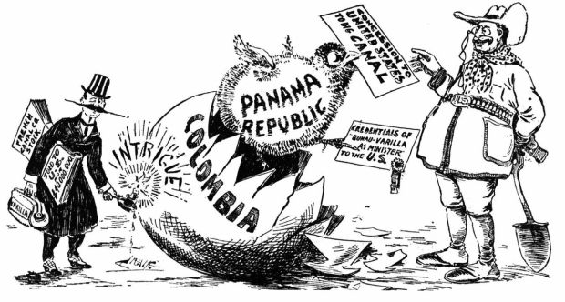
The special case of PANAMA deserves at least a few words. The Comandancy General of Tierra Firme was created in Panama in 1753. It was dependent on the viceroy of New Granada in administrative matters. The Comandancy General was originally to be dependent on the Audiencia of Lima (Peru) in judicial matters, as in previous centuries, but in 1752 these powers were transferred to the Audiencia of Bogotá.
The Comandancy General of Panama declared its independence from Spain in 1821 and joined Gran Colombia. When Venezuela and Ecuador left it, Panama continued to be part of Colombia (by then called republic of New Granada). Only in 1903, when Bogotà was opposing the plans of the US for the construction and subsequent administration of the future canal, Panama declared its independence from Colombia.
PERU-BOLIVIAN CONFEDERATION (1836-1839). It was formed by the republics of Bolivia, South-Peru and North-Peru. It included also the territories of Jujuy and Salta, today in Argentina, northern present-day Chile and part of today’s Brazilian Amazon rainforest.


In conlcusion, the huge territory of Spanish America, contrary to what happened in the British colonies of North America, which became remarkably larger principally through the seizure of ”Spanish lands” as we have seen, got shattered in many different new nations and national identities. Why? Who benefited from this? Only local elites? Probably only naive, ignorant and deeply indoctrinated people cannot see here the old strategy of divide and conquer.
BRAZIL, A COLONIAL CREATURE UNDER THE UMBRELLA OF THE UNITED KINGDOM
As I already pointed out many times, the Treaty of Tordesillas of 1494 delimited the borders between Spain and Portugal. Nevertheless, permanent habitation in Brazil did not begin until Sao Vicente (in the state of Sao Paolo) was founded in 1532 by Martim Afonso de Sousa, although temporary trading posts were established earlier to collect brazilwood, used as a dye in Europe.
At the beginning the Portuguese decided to assign the task of colonization to private entrepreneurs, called donatários, each of whom would become owner and administrator of an hereditary capitaincy (this fief system had already been successful in the settlement of the Portuguese colonies in Africa).
From 1534 to 1536, 15 captaincies were created in Portuguese America. The captaincies were autonomous, and mostly private fiefs of the Portuguese Empire, each owned and run by a Captain-major.

With the failure of most captaincies and the menacing presence of French ships along the Brazilian coast, Portugal decided to turn the colonization of Brazil into a royal enterprise. In 1549, a central government was established in Salvador da Bahia, which became Brazil’s first capital. In the 17th century, after the expulsion of the French, Rio de Janeiro became a far more practical export port than Salvador de Bahia, and the colonial administration was moved there in 1763.
FRANCE ANTARCTIQUE
Eager for a piece of land in South America, in 1555 France founded France Antarctique in Rio de Janeiro, a French colony which existed between 1555 and 1567, and had control over the coast from Rio de Janeiro to Cabo Frio. The French colony was ultimately destroyed by the Portuguese in 1567.
DUTCH BRAZIL
Also known as New Holland, was a colony of the Dutch Republic in the northeastern portion of modern-day Brazil. The Dutch managed to control the area from 1630 to 1654, when they were drove out by the Portuguese.
PORTUGUESE BRAZIL VERSUS SPANISH AMERICA
As we have seen, since the beginning of the Portuguese invasion of America, the Spanish and Portuguese borders established by the Treaty of Tordesillas were areas of conflict between the two Iberian kingdoms and their peoples. However, it was especially during the time lapse in which Portugal was annexed to the kingdom of Spain, from 1580 to 1640, when the Spaniards lessen their control over their colonial lands, that the Portuguese penetrated the Viceroyalty of Peru westwards and southwards. And were these ”illegal” Portuguese settlements that gave to Brazil its current shape.


Territorial evolution of Brazil.
PORTUGUESE EXPANSION SOUTHWARD was carried out principally by the ‘bandeirantes’ (called also ‘paulistas’) from the current state of Sao Paulo, who’s main economic activity was the trading of Native American slaves. Considered by the Spaniards land-pirates, in Brazil the bandeirantes are recognized for having taken the borders of Portuguese America far beyond those established in the Treaty of Tordesillas, defining the current limits of Brazilian territory.
PORTUGUESE EXPANSION WESTWARDS. Portuguese settlements spread in the Amazon Basin between 1580 and 1640. The Amazon Basin was part of the Spanish Viceroyalty of Peru. These territorial disputes were settled with the Treaty of Madrid of 1750 (and other concordats). The Treaty of Madrid was already based on the new principles of “who owns by fact owns by right” and “natural boundaries”, stating respectively in the preamble: “Each party must stay with what it now holds,” the same principles imposed by the British to the Spaniards in North America in the Nootka territory. Thereby it authorized the Portuguese to retain the lands they had occupied at the expense of the Empire of Spain. The treaty also stipulated that Spain would receive the Sacramento Colony (founded by the Portuguese opposite to Buenos Aires on the shore of the River Plate) and Portugal the Misiones Orientales, these were seven independent Jesuit missions of the upper Uruguay River, while the Treaty of Tordesillas was abrogated.
Thanks to the Treaty of Madrid, Brazil augmented considerably its size and substantially defined its modern boundaries.
SOME NOTES AND REFLECTIONS ON THE CARIBBEAN
Colonial history in the American Continent(s) could be briefly summed up as the history of invasions of Native American peoples’ lands by Europeans and the wars between Europeans to control pieces of those lands. The Treaty of Tordesillas, the oldest main piece of law settling the ownership of the lands ”discovered” by Christopher Columbus, gave to Spain most of those Native Americans’ territories and a little slice to the kingdom of Portugal. Thus, soon after, all other European powers were at war with the Spanish Empire – in a few rare cases against Portuguese Brazil – to get a piece for themselves. Therefore, all nations that are today part of France, the Netherlands, Great Britain in the American continent(s) or were their former colonies are sons of those wars against the Hispanic world.
These wars started at the beginning of the 16th century when all Europeans powers decided it was unfair that only Spain and Portugal could benefit from the riches of the lands taken from Native American peoples, and began to be interested in the Caribbean islands. Just to cite a few cases:
CURAZAO. In 1634 an expedition of the Dutch West India Company conquered the isle of Curazao. The small Spanish colony and almost the entire population of the Arawak Indians, who refused to swear obedience to the Netherlands, were expelled and took refuge on the shores of Venezuela.
JAMAICA. British pirates conquered Jamaica in 1655. The Spaniards had settlings only in the Southern part of the island.
HAITI. In 1697 Spain ceded to France the western third of the Hispaniola, which became Saint-Domingue (Haiti).
BAHAMAS. From the 15th century to the 18th century the Bahamas were under Spanish sovereignty. Due to their strategic location on the “Galleon Route”, they were gradually transformed into hiding places and nests of pirates, buccaneers and filibusters, especially English. In 1784, due to the large number of British settlers on the islands, sovereignty of the archipelago was transferred from Spain to the United Kingdom.
Before ending this long two parts report, I want to make you aware that even if their presence is null today, also the Danes and the Swedes managed to get some land in the Caribbean in the past.
DANISH VIRGIN ISLANDS. Consisting of the islands of Saint Thomas (1672), Saint John (1718), and Saint Croix (1733), Danish colonizers were exporting firearms and other manufactured goods to Africa in exchange for slaves as the economy of the Danish West Indies depended on slavery. For brief periods the islands were occupied by the British. After the abolition of slavery, the Danish parliament first debated the sale of the increasingly unprofitable colony in 1852. Denmark tried several times to sell or exchange the Danish West Indies in the late 19th and early 20th centuries to the United States and to the German Empire. The islands were eventually sold for 25 million dollars to the United States in 1917. The new ‘owner’ renamed them the United States Virgin Islands.
SWEDEN IN THE CARIBBEAN. The Swedish colony of Saint Barthélemy (1784–1878), located in the Lesser Antilles, was operated as a tax-free-zone. The isle came into Swedish possession as a consequence of the Napoleonic Wars. Sweden thought to sell it to the newborn kingdom of Italy or the US but at the end sold it to France. The transaction price was 80,000 francs for Swedish assets and 320,000 francs for the repatriation and retirement of Swedish officials. On 16 March 1878, the French officially reoccupied Saint Barthélemy.
After reading this two-part-report you probably have now a general idea about how present-day American countries got their shapes and borders. We have seen how Canada and the United States of America, both former British colonies, became remarkably larger. Brazil, which was for most of its colonial history a kind of protectorate of the kingdom of Great Britain also enlarged its territory conspicuously, while Spanish America, the only giant of colonial times, a huge territory extremely rich in natural resources, was divided into many countries and national identities.
History written by invaders is never the true history. Similarly, history written by the winners is never the true history. And history is always written by the victors.
Read the First Part of this report about Canada and the United States of America!

AUTHOR. Katia Novella Miller is an independent writer and researcher interested in topics that she finds interesting and important for the common good of humanity. Her objectives are to seek the truth and to unmask our false sense of normality and reality. For more information go to About Us, if you would like to contact Katia: katianovellamiller@protonmail.com
Share this special report! ⬇︎
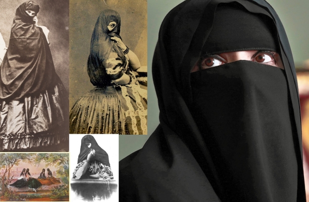
RELATED ARTICLES: Today’s American National Boundaries were Determined by Global Power in the Past: Canada & The United States, Birth and Formation – PART I – Hernan Cortes and Unknown Facts About The Panama Canal – How Politicians Built Racism in the USA – Francisco de Miranda’s Inca Federation, the dream of Hispanic American Unity after Independence from Spain – When a Niqab meant Freedom: las Tapadas, an old Non-Islamic Tradition – I’m American too! Are you sure? – How the USA created the post-war industrial-economic power of Germany and Japan and the European Union – Were There Maori of European-White Descent Before the British Invasion of New Zealand? – Ignorance Rules Over Hispanic America in Journalism, the case of Che Guevara
WAIT, DON’T GO! Writing the truth is dangerous. If you value our hard work, please consider supporting our efforts sharing our article and with a donation (below). Supporting global independent media todays is supporting your freedom tomorrow. Furthermore we need your help to keep publishing what mainstream media hides to you and inform the global community, please support our hard work!
Make a secure DONATION with PayPal or your Debit or Credit Card
Google, Facebook, Instagram, Twitter… are trying to silence independent media fighting for the truth and a better world. Given this fact, it is extremely important for people to search out information for themselves, go directly to our website and others, subscribe to diverse email lists, and not rely on social media for information. Please enter your e-mail and click to subscribe to get our reports in your inbox

Follow us! We are on the main social networks, Facebook, Twitter, Instagram, VK and Telegram (KBNBWorld). You can also follow as on our new video channels: BitChute, UGETube or You Tube.
Published images are taken from the Internet and considered public domain. If an image infringes copyrights please send an e-mail to kbnbworldnews@protonmail.com and it will be immediately removed.
KBNBWorldNews is a Non-Profit News Organization.
Contact with the editorial office: kbnbworldnews@protonmail.com
Media: Republishing Guidelines


KBNBWorldNews Copyright
